

You’re roughly 20 miles offshore. The sun has dipped below the horizon, and a biting chill is replacing the comfortable warmth of the day. The fog is rolling in, thick, grey, and disorienting.
You glance at your chart plotter for reassurance, expecting that familiar glow, but the screen flickers and cuts to black. The electronic navigation device has failed, leaving you without your primary means of digital navigation.
Silence.
In that split second, the difference between a panicked amateur and a professional skipper becomes crystal clear.
Where are you?
Could you get your crew home safely without the satellites guiding you? In some conditions, such as heavy overcast or daylight, traditional celestial navigation can become nearly impossible.
Still, advanced yacht navigation and charting techniques, especially those using automated systems, can overcome these challenges and keep you on course.
At Certified Training, we tell our students that technology makes boating easier, but training makes it safer. The ocean doesn’t care about your expensive electronics; it respects skill, preparation, and respect for the elements.
True seamanship isn’t about pushing buttons; it’s about understanding the sea so deeply that you can navigate it with a pencil and a compass if you have to.
The physical body of historical navigation devices, like the compass or sextant, was essential for determining direction before electronic systems, relying on precise mechanical structure to guide mariners.
Professionals use advanced techniques to correct for errors and refine positional accuracy, ensuring safe passage even when technology fails.
In this guide, we’re going to walk you through the advanced techniques that separate the coastal hoppers from the true navigators. We’ll explore how we blend old-school discipline with modern tech to ensure that, no matter what happens out there, you remain the master of your vessel.
What Defines Advanced Yacht Navigation?
Moving Beyond the Basics
When you first start sailing, navigation is usually about answering one question: “Where am I right now?” It’s reactive. You see a buoy, you check the chart, and you confirm you aren’t lost.
But advanced yacht navigation, the kind we teach in our higher-level courses, answers a much more critical question: “Where will I be in an hour, and is it safe?” The aim of advanced yacht navigation and charting techniques is to ensure safety and precision by anticipating future positions and potential hazards before they arise.
This is a mindset shift. It moves you away from visual coastal hopping, where you’re just connecting the dots between landmarks, to offshore precision. It’s about predicting the future of the vessel.
Advanced navigation techniques require you to project your vessel’s movement forward along the intended course, using compass direction and speed as key factors, much like how pedestrian dead reckoning (PDR) systems track forward movement based on direction and displacement.
It requires you to calculate variables like wind shifts, tidal streams, and hull speed long before you even encounter a hazard. It’s proactive, not reactive.
The Integrated Approach
One of the first things you’ll learn with us is that a professional skipper is a skeptic. We never trust a single source of information. If the GPS says we are safe, but our eyes see breaking waves, we trust our eyes.
We call this the Integrated Approach. It’s the art of combining visual checks out the window, electronic data from the plotter, and raw calculations on paper charts.
A modern navigation system integrates these visual, electronic, and manual data sources, consolidating information from GPS, inertial sensors, and other inputs to enhance reliability and safety.
This integration significantly improves the accuracy and reliability of position information, which is essential for resilient navigation, especially when environmental factors or equipment limitations affect individual data sources.
By cross-referencing these three sources, we create a safety net. If the electronics disagree with the paper chart, we don’t guess; we slow down and investigate.
Situational Awareness
High-level navigation requires intense mental mapping. You need to be processing information faster than the hull is moving through the water. In the industry, we call this “staying ahead of the boat.”
Developing a strong sense of direction and spatial awareness is crucial for advanced yacht navigation and charting techniques, as it allows you to intuitively perceive your vessel’s position and angle of approach in relation to your surroundings.
If you are reacting to a buoy only when you physically see it, you are already behind. Situational awareness means knowing what the depth sounder should read before you even glance at the screen.
Navigators should never forget to consider all available information, including environmental cues and instrument readings, to maintain accurate situational awareness. It’s about building a 3D mental picture of the seabed, the traffic, and the wind that matches reality.
How Do Vector and Raster Charts Differ?
Understanding the Formats
Walk onto the bridge of any modern vessel, and you’ll likely see an Electronic Chart Display and Information System (ECDIS). But not all digital charts are created equal. Knowing the difference between the two main formats can save you a lot of confusion.
Think of Raster charts as digital photographs. They are essentially scans of the traditional paper maps you buy in a shop. They look familiar, they have the same text style, and they feel “real.” The scale of a raster chart determines how much detail is visible, with larger scale charts providing more precise information for close navigation.
Vector charts, on the other hand, are intelligent databases. They aren’t images; they are computer-generated renderings where every line, depth contour, and buoy is a piece of layered data. The scale of vector charts can be adjusted, but navigators must ensure the displayed scale is appropriate to maintain accuracy and detail for safe route planning and monitoring.
Both raster and vector charts are designed to help navigators determine their position on Earth with accuracy, supporting advanced yacht navigation and charting techniques.
Pros and Cons: The “Look” vs. The “Data”
Choosing between these formats changes how you interpret what you’re seeing. Here is how we break it down for our students:
- Raster Charts (The Scan):
- The Good: They provide all information at once. Nothing is hidden in a menu, so you get the “big picture” instantly.
- The Bad: When you zoom in, the image blurs and pixelates like a low-quality photo. Plus, if you turn the chart upside down (Head Up), the text turns upside down too!
- Vector Charts (The Smart Map):
- The Good: You can zoom in forever, and the lines stay crisp. You can also click on a buoy to get a pop-up with its light characteristics.
- The Bad: This is the big risk; if your settings are wrong, critical dangers can be “hidden” in layers to reduce screen clutter. You might think the water is clear, but the rock is just turned “off.”
Official hydrographic services are responsible for producing and updating both raster and vector charts, ensuring that navigational information is accurate and reliable for advanced yacht navigation and charting techniques.
Selecting the Right Chart
At Certified Training, we generally recommend Vector charts for offshore passage making and tight harbor entries because of their clarity. However, Raster charts are excellent for that broad overview when you’re planning.
A major warning we always give: Beware of “over-zooming” on Vector charts. Because the lines stay crisp, you might think you have accurate data for a tiny cove, even if the original survey was done in 1890 with a lead line! Always check the “Source Data” to see when the area was actually mapped. Additionally, always verify the accuracy of the positional information provided by the chart, especially in unfamiliar or poorly surveyed areas, as relying on inaccurate location data can compromise safe navigation.
Why Are Radar and AIS Critical for Safety?
Seeing in the Blind
When the weather turns, and visibility drops to zero, your eyes become useless. This is when Marine Radar plotting becomes your superpower. Radar doesn’t care about fog or darkness; it allows you to detect landmasses, other boats, and even incoming squalls.
We teach our students to use Radar to create a “guard zone” around the yacht. It paints a picture of hard objects relative to you. Modern radar systems can also track the movement of nearby vessels and objects, providing real-time updates on their course and speed to enhance situational awareness.
In radar plotting, determining the aspect and relative position of a target vessel often involves measuring the angle between two lines of sight; these ‘two lines’ typically represent different reference points or bearings that intersect at the target’s location.
Mastering the gain and clutter controls is an art form; it ensures you see real targets (like a container ship) rather than just wave tops or heavy rain.
Check our RYA Radar course to learn more.
The Role of AIS
AIS collision avoidance has completely revolutionized safety at sea. The Automatic Identification System (AIS) acts like a digital handshake between vessels. It shouts out your data and listens to everyone else’s.
With AIS, you can instantly see a ship’s name, speed, course, and, most importantly, the Closest Point of Approach (CPA). This helps you make decisions early. Additionally, AIS can provide the value of a vessel’s aspect angle (ranging from 0 to 180 degrees), which indicates the relative bearing of the target vessel.
Understanding this value is crucial for assessing collision risk and making informed navigational decisions, especially when interpreting visual signals like red and green lights. But remember: not every small fishing boat carries AIS. Just because your screen is empty doesn’t mean the ocean is. It does not replace the need for a physical watch.
Radar vs. GPS: The Trust Test
One of the best habits you can form is checking your GPS against your Radar. Use a Variable Range Marker (VRM) on the Radar to measure the distance to a known landmark, like a headland.
Never rely solely on one navigation system; always cross-check your position using multiple sources such as radar, GPS, and visual bearings. Obtaining a reliable fix on your position from these sources is essential for safe navigation and serves as the starting point for dead reckoning calculations.
If the Radar says the cliff is 2 miles away, but the GPS puts you 1.8 miles away, stop. Something is wrong. This redundancy ensures that a satellite error doesn’t drive you onto the rocks.
How Do You Create a Fail-Safe Passage Plan?
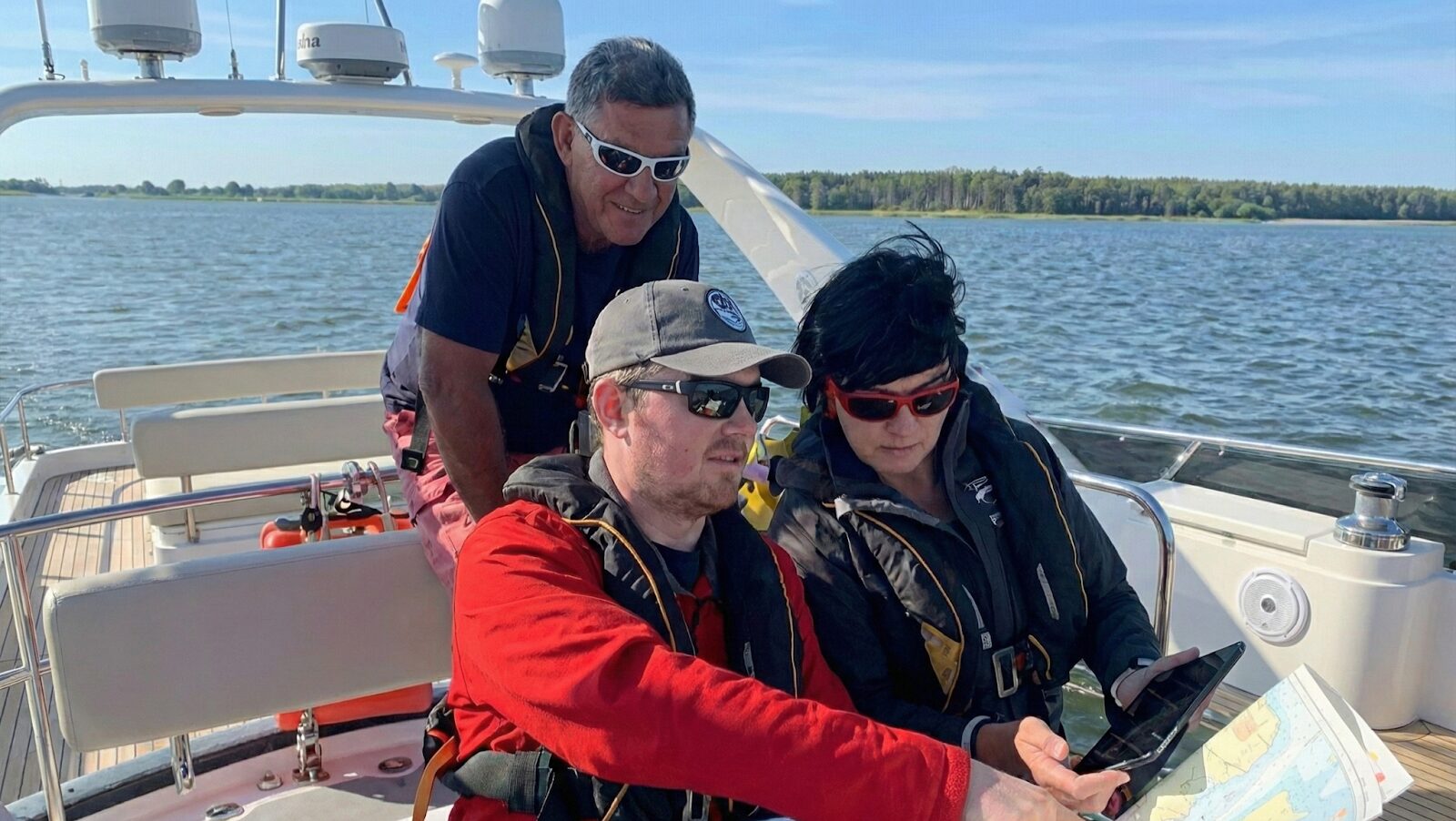
The APEM Model
Planning isn’t just drawing a line on a map. Professional planning follows the APEM model: Appraisal, Planning, Execution, and Monitoring.
Appraisal is your homework phase, gathering charts, almanacs, and weather data. Planning is the strategy, where the intended route is carefully drawn on the chart to visualize the planned passage and ensure all navigational hazards are considered.
Execution is the voyage itself, and Monitoring is the constant checking of your progress. If you skip the Appraisal, the Execution will likely go wrong.
Weather and Tides
A straight line on a chart looks great, but the ocean moves. We have to perform detailed tidal stream calculations to ensure we aren’t fighting a 4-knot current the whole way. Before setting out, it is essential to obtain accurate tidal and weather data to inform these calculations and improve navigation safety.
We also need to calculate tidal heights. There is nothing more embarrassing (or dangerous) than arriving at your destination at Low Water only to find there isn’t enough depth under your keel. We drill these calculations in our classrooms so they become second nature.
Contingency Planning
Things rarely go exactly according to plan at sea. Engines overheat, sails rip, and crew members get seasick. A robust passage planning checklist always includes “Ports of Refuge.”
These are your “Plan B” stops. They are safe havens identified along your route where you can duck in if the weather turns or you have mechanical issues.
Electronic navigation systems, such as ECDIS, can assist in identifying and selecting suitable ports of refuge along your route by providing up-to-date navigation-related information.
Knowing exactly where to run for cover stops panic before it starts. STCW security awareness training is critical for situations like these.
Why Does Dead Reckoning Still Matter?
The Ultimate Backup
In an age of satellites, Dead Reckoning positions (DR) might seem like ancient history. But DR is the only navigation method that requires no electricity, no batteries, and no external signal.
Dead Reckoning is simply calculating your position based on three things: how fast you are going, how long you have been doing it, and what direction you are heading. If the electronics blackout, a DR plot is your lifeline. It is the rawest form of navigation.
Dead reckoning is used to determine your current position by projecting your course and speed from a known past position, allowing you to estimate your location when electronic aids are unavailable.
When GPS Fails
Electronics are fragile. They fail from salt corrosion, lightning strikes, or simple power outages. If the screens die, and you haven’t been plotting a DR, you are effectively lost.
We advocate maintaining a paper chart with a pencil plot running alongside your electronic systems. It takes moments to update but provides immense peace of mind. It ensures you always know roughly where you are, no matter what the screens do.
Estimated Position
A DR plot assumes you are moving in a straight line, but the ocean pushes you around. To get an Estimated Position (EP), we refine the plot.
We apply the effects of wind pushing us sideways (leeway) and the current pushing us off course (set and drift). Additionally, a navigator measures angles and bearings, such as taking sights of celestial bodies, to further improve the accuracy of the estimated position. This calculation gives us a much more accurate “circle of probability” regarding our location. It’s about turning a guess into a calculated estimate.
How Do You Navigate Safely at Night or in Fog?
Interpreting Lights
Night navigation turns the world into a puzzle of blinking lights. To the untrained eye, it’s chaos. To a navigator, it’s a language.
We teach you how to identify lighthouses and buoys by their “light characteristics.” This involves counting the flashes and timing the darkness. For example, a lighthouse might be marked “Fl(3) 15s,” meaning it flashes three times every 15 seconds.
Additionally, noting the angle at which a light is observed can help determine your vessel’s position relative to the light source, providing another layer of positional accuracy. Confirming this with a stopwatch is one of the most satisfying feelings in navigation, it confirms, without a doubt, exactly where you are.
Soundings as Signposts
When you can’t see the land, look down. The depth sounder is one of the most underrated navigation tools on a boat.
By watching the depth change, you can follow underwater contour lines. If the chart says the seabed drops from 20m to 50m at a specific line, and your sounder reflects that drop, you have a position line. It acts as a confirmation that you are exactly where you think you are.
Watchkeeping Rhythms
Fatigue is the enemy of safety. Navigating in fog or darkness requires intense concentration. You need to organize crew shifts to ensure someone is always alert. Keep the watch schedule free of unnecessary complexity to maintain alertness and efficiency.
We recommend shortening watch periods during difficult conditions. Nobody can stare at a Radar screen for 4 hours straight without zoning out. Ensure the person on the helm has a second pair of eyes checking the instruments. Teamwork is a navigation tool, too.
Why Is Keeping a Logbook Essential?
Legal Protection
Many sailors view the logbook as a chore, something to scribble in when they remember. But in reality, it is a legal shield. In the unfortunate event of an accident or insurance claim, the logbook is the primary evidence.
It proves that you were navigating responsibly. It shows you were monitoring your position, checking the weather, and maintaining the vessel. Without it, it is just your word against the insurers. At Certified Training, we emphasize that a good logbook is a sign of a disciplined skipper.
Data Redundancy
Beyond legalities, the logbook is your data backup. We recommend writing down GPS redundancy coordinates, course, log reading, and speed every hour. Ensure the accuracy of these logbook entries, as precise and reliable data is essential for effective navigation backup.
If a lightning strike fries the boat’s electronics, that logbook contains your last known position. You can plot that point on the paper chart and start your Dead Reckoning from there. It bridges the gap between a crisis and a solution.
FAQs
What is the difference between coastal navigation and advanced yacht navigation?
Coastal navigation relies largely on visual references, seeing things like buoys and landmarks. Advanced yacht navigation involves offshore passages where land is out of sight, requiring reliance on electronic systems, celestial navigation basics, and dead reckoning to predict where you will be, rather than just seeing where you are.
Why do I need paper charts if I have a GPS chart plotter?
Paper charts are your fail-safe. Electronics can fail due to power loss, water damage, or signal interference. A paper chart allows you to continue navigating safely using dead reckoning and visual bearings when technology lets you down.
What is Dead Reckoning in yacht navigation?
Dead Reckoning (DR) is the process of estimating your current position based on a previously determined position. You calculate it using only your speed, elapsed time, and the course you steered. It’s the “purest” form of navigation as it doesn’t account for wind or current yet.
How does Radar help with navigation effectively?
Radar allows you to “see” in blind conditions like fog or night. It helps identify landmasses for positioning and detects other vessels to prevent collisions. It also allows you to cross-check distances against your GPS to ensure your satellite data is accurate, as discussed earlier when comparing manual and electronic position fixes.
What are vector charts?
Vector charts are digital charts built from a database of layers. They allow you to zoom in without losing clarity and let you click on objects for more information. However, you must be careful with your display settings to ensure hazards aren’t hidden from view.
How often should I log my position in the logbook?
We recommend logging your position, course, and speed at least once every hour during offshore passages. In complex coastal waters or poor weather, you should log it more frequently, every 15 to 30 minutes.
What is an Estimated Position (EP)?
An Estimated Position (EP) is a more accurate version of a Dead Reckoning plot. It takes your DR position and adjusts it for the effects of leeway (wind) and tidal set and drift (current) to give you a more probable location.
What are inertial navigation systems, and how are they used in advanced yacht navigation?
Inertial navigation systems use accelerometers and gyroscopes to determine a vessel’s position, orientation, and velocity without relying on external signals like GPS. In advanced yacht navigation, these systems provide precise dead reckoning calculations and maintain navigation accuracy even when GPS signals are unavailable or unreliable, such as during offshore passages or in challenging conditions.
Conclusion
At the end of the day, advanced navigation is about confidence. It’s the confidence to leave the harbor knowing that, no matter what the ocean throws at you, whether it’s a sudden squall, a power outage, or a thick fog bank, you have the skills to handle it.
At Certified Training Superyacht Training Academy, we don’t just teach you how to pass an exam; we teach you how to be a skipper who commands respect. We want you to feel the satisfaction of a perfect landfall and the peace of mind that comes from true preparation.
If you’re ready to move beyond the basics and truly master the art of navigation, we are here to help you take that next step. Whether you are looking to brush up on your chart work or aiming for your Yachtmaster qualification, let’s get you out on the water and learning.
Ready to upgrade your skills? Browse our advanced navigation courses today and join a community of sailors who take safety seriously.